Disclaimer: I know climate change and forecasts are highly controversial. I understand climate meteorology has become weaponized for politics and has grown past simply being a tool for stakeholders. That being said, there are many types of model projections and I am simply posting forecast/projections on this page.
Links for various Climate models and projections
| Environmental Protection Agency CREAT Climate Map CREAT | North America Regional Climate Change Assessment Models NARCCAP |
| U.S Climate Resilience Tool Kit Climate Explorer | United States Geological Survey Land Resource Viewer |
| Climate Central Risks Risk Zone Map | National Snow and Ice Data Center NCIDC |
| Sea Ice Extent Plots Northern Hemisphere MASIE |
GFDL CM.2 NOAA Temperature Projections Through 2100

Charts/Graphs
NCICS Temperature Change for PA
![[object Object]](https://statesummaries.ncics.org/img/figure/pa-figure-1.jpg)
Projections courtesy of Climate Explorer. Red for higher emissions, blue for lower.
Temperature change for Philadelphia

Days with Temps >100

Precipitation

Days for crop growth (warmer temps + slow rise in more precip)

Days requiring cooling (defined as air temp >65) which is reflective of demand for energy

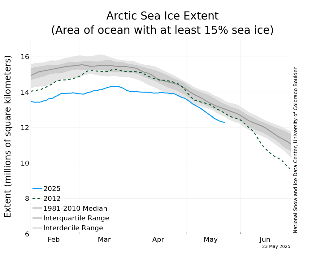
Current Sea Ice Extent and Monthly Projections

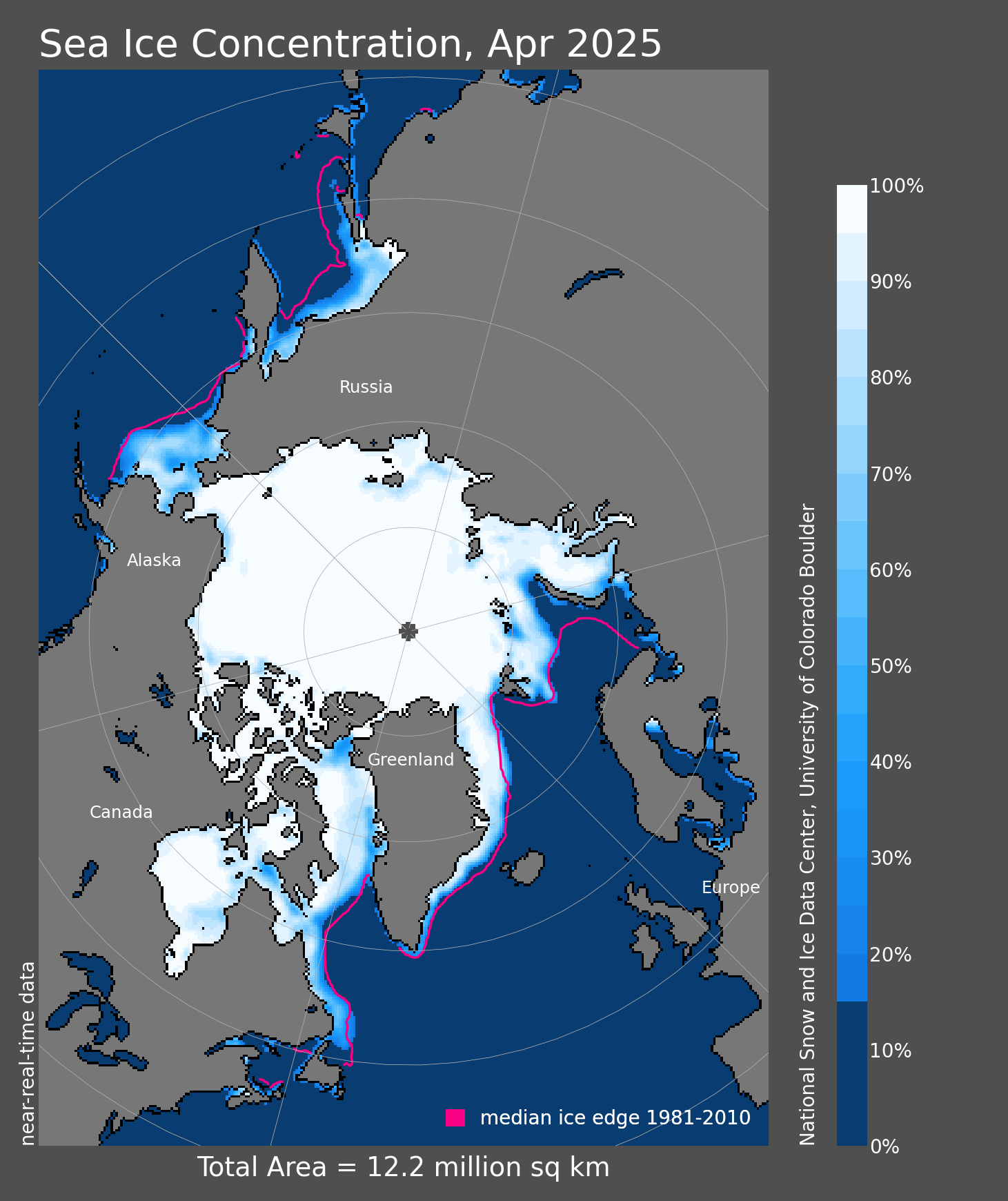
Sea Ice Concentration

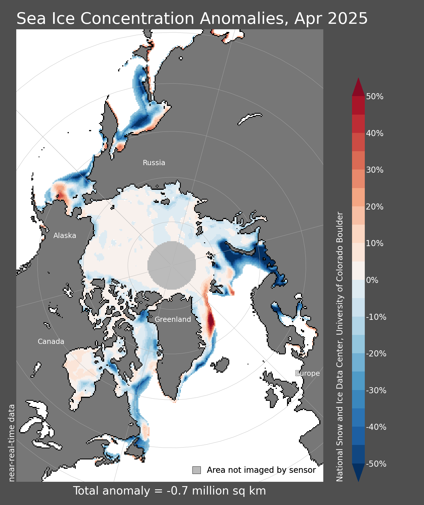
Sea Ice Concentration Anomaly

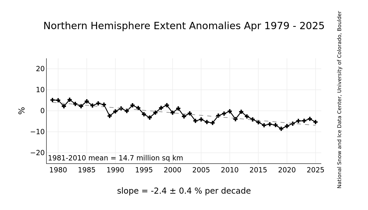
Sea Ice Extent Anomaly Chart

Northern Hemisphere Sea Ice Extent Last 4 Weeks (and yearly comparison)

Arctic Sea Ice Extent

